
Global directory
Search the full destination catalog
This page now loads one paginated slice at a time. Start broad here, then move into country collections for a tighter regional browse.
Zambia
Open country page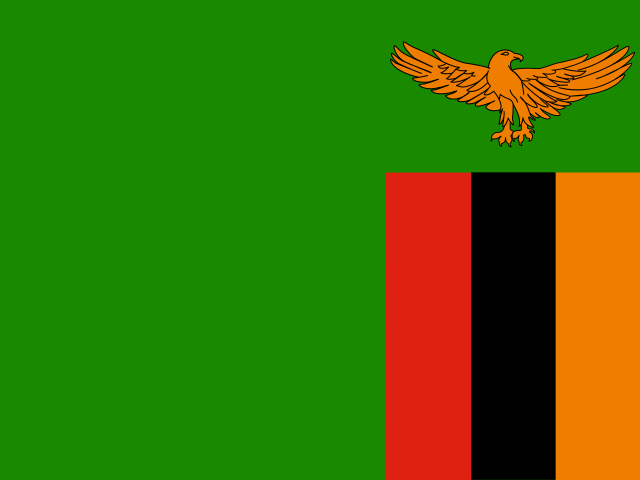
Choma
Southern
Choma is the capital of the Southern Province of Zambia. Situated along the main highway between Lusaka and Livingstone, it is a significant agricultural and commercial town. While not a major tourist destination in itself, it offers a glimpse into authentic Zambian life and culture. The town is most notable for housing the Choma Museum and Crafts Centre, which preserves and showcases the history and culture of the Tonga people. Visitors can experience local markets, learn about traditional crafts, and use Choma as a stopover or base for exploring the wider Southern Province, though specific major attractions within the town are limited beyond the museum.
Itezhi-Tezhi District
Southern
Itezhi-Tezhi District is a largely rural and remote area situated in the Southern Province of Zambia. Its most defining feature is the Itezhi-Tezhi Dam on the Kafue River, which created the expansive Itezhi-Tezhi Lake. This lake and the surrounding land form a critical part of the ecosystem for the abundant wildlife within Kafue National Park, which borders the district. The district's economy is predominantly based on fishing, limited agriculture, and tourism centered around the lake and the national park. Visitors can expect an immersive experience in Zambian wilderness, characterized by diverse birdlife, various animal species, and tranquil waterways.
Kaputa
Northern
Kaputa is a rural town in Zambia's Northern Province, serving as the headquarters of Kaputa District. The area is characterized by vast wetlands, swamps, and savanna landscapes. The town is situated near the Luapula River, which flows from Lake Bangweulu toward Lake Tanganyika. The local economy is primarily based on agriculture, fishing, and small-scale trading. Kaputa lies in a region with tropical savanna climate, experiencing distinct wet and dry seasons. The area is relatively remote and off the typical tourist circuit, offering visitors an authentic glimpse of rural Zambian life away from major tourist destinations.
Limulunga
Western
Limulunga lies in the floodplains of Western Zambia, a short distance from Mongu, the provincial capital. It is the traditional capital where the Litunga, the king of the Lozi people, resides during the dry season. Each year, usually around April when the Zambezi floodplain waters rise, the Litunga moves by royal barge (nalikwanda) from Lealui to Limulunga in the celebrated Kuomboka ceremony, one of southern Africa's most significant traditional festivals. The village retains a strong royal and cultural character, offering visitors an authentic glimpse of Lozi traditions, royal architecture, and floodplain life.
Livingstone
Southern Province
Livingstone is a historic city in the Southern Province of Zambia, founded in 1905 and named after the Scottish explorer and missionary David Livingstone. It served as the capital of Northern Rhodesia (colonial Zambia) until 1935. Today, the city is the primary hub for visitors to the spectacular Victoria Falls, one of the Seven Natural Wonders of the World, and to the surrounding Mosi-oa-Tunya National Park. The Zambezi River flows along its southern edge, and the city is connected to Victoria Falls Town in Zimbabwe via the historic Victoria Falls Bridge. Livingstone blends colonial-era architecture with vibrant local culture, offering museums, craft markets, and cultural villages alongside adventure tourism infrastructure. The area supports a thriving ecosystem of wildlife and is a key base for safari, river cruise, and adrenaline-sport activities.
Lusaka
Lusaka
Lusaka is the capital city of Zambia and one of the fastest-growing cities in Southern Africa. Founded as a colonial settlement in 1905, it became the capital of the newly independent Zambia in 1964. Today, Lusaka is a bustling metropolitan area with a population of over 2 million in the metropolitan region. The city features a mix of colonial-era architecture, modern high-rises, shopping malls, and traditional markets. Key landmarks include the Lusaka National Museum, the Freedom Statue commemorating Zambia's independence, and the bustling Lusaka City Market. The city serves as the primary entry point for international travelers, with Kenneth Kaunda International Airport offering connections to major African cities and beyond. Lusaka's economy is diverse, with strong sectors in manufacturing, services, mining (though mining is more concentrated in the Copperbelt), and agriculture.
Mpongwe
Copperbelt
Mpongwe is a small town located in the Copperbelt Province of central Zambia, serving as the administrative center of Mpongwe District. The town lies along the Great North Road, the principal highway linking Lusaka with the Copperbelt mining cities and continuing northward toward the Democratic Republic of the Congo. Mpongwe is surrounded by farmland and woodland typical of the region's mixed agricultural landscape, with local economic activity centered on smallholder farming, maize cultivation, and roadside commerce. While the Copperbelt Province is best known for copper mining activity in cities such as Ndola, Kitwe, and Mufulira, Mpongwe itself is more agricultural in character. Travelers passing through the area typically use Mpongwe as a brief stopover rather than a destination, though it provides a glimpse of rural Copperbelt life away from the larger urban centers.
Mporokoso
Northern Province
Mporokoso is a rural town situated in the Northern Province of Zambia, near the southern shore of Lake Tanganyika's watershed area and within reach of significant wetlands and protected areas. The town lies in a sparsely populated region characterized by miombo woodland, seasonal swamps, and a network of rivers draining toward the great lakes of East Africa. As the headquarters of Mporokoso District, it functions as a modest administrative and trading hub for surrounding communities, with a small commercial center, basic services, and a slow-paced rural atmosphere. The town is notable primarily as a launching point for travelers exploring the Bangweulu Wetlands (a Ramsar-listed site of global ecological importance, home to the endemic black lechwe and shoebill stork) and Mweru-Wantipa National Park, both of which lie within the district. Local livelihoods revolve around subsistence agriculture, fishing in nearby waterways, and small-scale trade.
Mwinilunga
Northwestern Province
Mwinilunga is a quiet district administrative town in the Northwestern Province of Zambia, situated on the gently undulating wooded plateau near the tri-border area with Angola and the Democratic Republic of the Congo. The town lies in a region of miombo woodland and dambos (seasonally waterlogged grasslands) and is best known to travelers as the base for excursions to the nearby Zambezi Source National Forest, where the Zambezi River begins its long journey toward the Indian Ocean, and to West Lunga National Park, a remote protected area known for wildlife and birdlife. The local economy is largely based on subsistence farming, small-scale trade, timber, and cross-border commerce. The surrounding district is home to the Kaonde people as well as significant Lunda and Luvale populations, whose traditional villages and ceremonies remain an important part of life in the area. Mwinilunga itself is a modest settlement with a market, basic services, a small hospital, a district administration, and a handful of guesthouses, making it a useful stopover for self-sufficient travelers heading into the more remote parts of northwestern Zambia.
Ndola
Copperbelt
Ndola lies in the north-central Copperbelt Province of Zambia, roughly 350 km north of Lusaka, and serves as the provincial capital and one of the country's principal industrial and commercial hubs. The city grew around the copper industry after large-scale mining began in the 1920s and was the site of the 1979 Church of Africa compounds siege, an event that marked it in Zambian and Southern African history. Today's economy is anchored by mining and metallurgy (copper and cobalt processing, the Nkana and Chambishi smelters nearby), rail freight, and a growing service sector. The surrounding Copperbelt is a fertile, heavily settled farming region, and Ndola functions as the regional transport gateway with air links to Lusaka and international routes, a central railway junction, and major paved highways running south toward Kitwe and north toward the DRC border and the Luapula Valley. Beyond the city, the landscape opens into miombo woodland, the Zambian CopperbeltUNESCO-listed colonial-era mining towns such as Luanshya and Roan Antelope, Kafue National Park to the west, and Lake Mweru and the Luapula Valley to the north. The city itself combines a modern commercial core, industrial suburbs, broad avenues, established hotels and conference facilities, and quiet residential districts ringed by bushveld. For travellers, Ndola is a practical stopover: a well-serviced regional capital with reliable road connections to Lusaka and Kitwe, day-trip access to Kafue National Park and the Copperbelt mining heritage sites, and a noticeable South African and Congolese cultural influence alongside distinctly Zambian traditions.
Siavonga District
Southern
Siavonga District lies along the northern shoreline of Lake Kariba in Zambia's Southern Province, with the town of Siavonga acting as the main commercial and tourism hub. The district stretches across rugged escarpment country that drops down to the vast lake created by the Kariba Dam in the late 1950s. The Tonga people, who were historically displaced from the Zambezi valley when the dam was filled, remain the predominant local community, and their fishing villages dot the shoreline. Siavonga is a weekend and holiday escape for residents of Lusaka, located roughly 170 km to the north, and it serves as the launch point for houseboat safaris, sport fishing expeditions targeting tigerfish and bream, and day cruises around the lake's inlets and islands. The landscape combines mopane woodland, rocky outcrops, and wide blue waters, with wildlife such as hippos, crocodiles, and numerous bird species present along the shoreline.
Zambezi
Northwestern Province
Zambezi is the principal settlement and administrative center of Zambezi District in Zambia's Northwestern Province. The town sits on the edge of the Zambezi River's upper catchment, although the river itself lies well to the east in a neighbouring province. The settlement has retained its older colonial-era name of Balovale in local usage, and was renamed Zambezi in line with the district. The area is remote, road-connected only via gravel and earth roads, and serves as a service centre for surrounding rural communities. The population is predominantly Luvale, with significant Lunda communities, and the region is known for its rich intangible heritage, including the Makishi masquerade performed during initiation rites and other ceremonies. The surrounding landscape consists of miombo woodland, riverine forest, and seasonal wetlands typical of the upper Zambezi basin. Tourism infrastructure is limited and the town mainly caters to overland travellers, NGO workers, and visitors exploring the cultural traditions of northwestern Zambia or heading further west toward the sources of the Zambezi River.
Monze
Southern
Monze is a small town located in the Southern Province of Zambia, situated in the central-southern part of the country. The town is situated in a predominantly rural area known for agricultural activities, particularly maize farming and cattle ranching. Monze serves as a local administrative center for the surrounding rural communities and is historically associated with the Lenje people, an ethnic group native to this region of Zambia. The town is characterized by its laid-back rural atmosphere and serves as a gateway for travelers exploring the southern parts of Zambia, though it is not a major tourist destination in itself. The local economy is primarily based on agriculture, with farming and small-scale trading forming the backbone of community life.
Namwala
Southern
Namwala is a regional town located in Zambia's Southern Province, positioned along the banks of the Kafue River, one of the major rivers in Zambia. The town serves as the capital of Namwala District and functions as a local trading center for the surrounding agricultural communities. The area is characterized by savanna vegetation and lies within the Kafue Basin region. Namwala has a predominantly rural character with local markets, small businesses, and residential areas. The Kafue River provides fishing opportunities and serves as a water source for local agriculture. The town is connected to the wider region by road networks, though infrastructure is basic compared to larger Zambian cities. Local communities primarily engage in small-scale farming, fishing, and livestock keeping.
Zimbabwe
Open country page
Banket
Mashonaland West
Banket is a rural agricultural town in Mashonaland West province, approximately 90 kilometers northwest of Harare. The town developed as a service center for the surrounding agricultural region, which consists mainly of commercial and subsistence farms. The area is characterized by relatively flat terrain at high elevation (around 1,200 meters above sea level), with fertile soils that support diverse crop production. Banket represents a typical Zimbabwean provincial town where agriculture forms the economic backbone, with local markets serving farmers from surrounding villages. The population is modest, primarily consisting of farmers, small business owners, and local workers. Visitors to Banket will find a genuinely rural Zimbabwean experience far from tourist crowds, with authentic local culture and community interactions.
Beitbridge
Matabeleland South
Beitbridge is a transit-oriented town in southern Zimbabwe, positioned directly across the Limpopo River from its South African counterpart, Musina. The town functions primarily as one of the busiest inland border crossings in southern Africa, handling a high volume of commercial and passenger traffic between Zimbabwe and South Africa. Beitbridge lies in a hot, low-lying area of the Limpopo valley and has expanded rapidly due to cross-border trade, with a mixed population that includes Shona, Ndebele, and Venda communities reflecting its position at a cultural crossroads. Beyond its role as a border post, the surrounding landscape features mopane woodland and dry savanna typical of the Limpopo basin.
Beitbridge District
Matabeleland South
Beitbridge District serves as the primary border crossing between Zimbabwe and South Africa, handling significant volumes of trade and passenger traffic. The town itself is relatively small but economically important, featuring the actual bridge crossing over the Limpopo River that connects the two countries. The area features semi-arid lowveld terrain with hot temperatures, situated in Zimbabwe's southern region near the border. The district includes both urban settlement areas around the border post and surrounding rural villages. Visitors pass through here en route to major Zimbabwean destinations like Bulawayo, Victoria Falls, or South Africa's Limpopo province. The border operation runs continuously, though wait times can be lengthy during peak periods. The local economy relies heavily on cross-border trade, informal vending, and transport services.
Bikita District
Masvingo
Bikita District is a rural administrative district located in Masvingo Province, eastern Zimbabwe. The district is notably known for the Bikita Minerals mine, one of the world's largest lithium mines, which has brought international attention to the area in recent years due to the global demand for lithium batteries. The region is predominantly agricultural with subsistence farming as the primary livelihood for most residents. The area features rolling hills and rural landscapes characteristic of Zimbabwe's eastern highlands. Bikita is about 75 kilometres southeast of Masvingo town and offers visitors an authentic glimpse into rural Zimbabwean life away from the more tourist-heavy areas of the country. The local population primarily speaks Shona and practices traditional customs alongside modern influences from mining operations."
Bindura District
Mashonaland Central
Bindura District is a rural administrative district in Mashonaland Central Province, northern Zimbabwe. The district is centered around Bindura town, a modest mining and trading center situated along the main road between Harare and the northern regions of Zimbabwe. The area is characterized by rolling rural landscapes, agricultural farmland, and small-scale mining activity. Bindura has historically been associated with nickel mining operations in the region. The local economy is primarily based on agriculture, small-scale mining, and trading. The population consists largely of Shona-speaking people engaged in farming and local commerce. While not a major tourist destination, the district offers visitors an authentic glimpse into rural Zimbabwean life away from the more touristy areas.
Binga District
Matabeleland North
Binga District is a rural administrative district in Matabeleland North Province, Zimbabwe, situated along the Zambezi River valley. The district is best known for the famous Binga Bridge (also called Otto Bridge), a striking single-arch bridge that connects Binga to the southern bank of the Zambezi River. The area is predominantly rural with dispersed settlements, and serves as a gateway for travelers heading to Lake Kariba and Zambia. The local economy revolves around fishing, small-scale agriculture, and tourism related to the Zambezi River's excellent fishing opportunities, particularly for tiger fish and bream. The district seat is the town of Binga, which features a local hospital, schools, and markets. The landscape is characterized by low-lying savanna woodland along the river valley, with the escarpment to the south rising to higher ground.
Chakari
Mashonaland West
Chakari is a small town located in the Mashonaland West province of Zimbabwe, situated at coordinates -18.06294, 29.89246. The town was historically associated with gold mining operations in the region. Today, it serves as a local service center for the surrounding agricultural and mining communities in this part of central Zimbabwe. The settlement offers visitors an authentic experience of rural Zimbabwean life away from major tourist crowds, with access to local markets, community interactions, and the opportunity to explore the surrounding countryside of Mashonaland West province."
Chegutu
Mashonaland West
Chegutu is a small but economically significant town situated in the heart of Zimbabwe's agricultural belt, Mashonaland West. Its economy is predominantly driven by farming, with large commercial farms specializing in tobacco, maize, and cotton. The town itself provides essential services to the agricultural sector and the local populace, including markets, schools, and medical facilities. While not a primary tourist destination, Chegutu offers a glimpse into rural Zimbabwean life and the backbone of its agricultural industry. The pace of life is generally slower, reflecting its provincial nature, and visitors can experience local markets and interact with the friendly community.
Chegutu District
Mashonaland West
Chegutu District is situated in the Mashonaland West Province of Zimbabwe. It is characterized by fertile agricultural land, primarily engaged in cash crop farming and livestock rearing. The district provides an authentic experience of rural Zimbabwean life, with local markets, traditional homesteads, and community interactions. While not a major tourist hub, it serves as an important agricultural center and offers insights into the country's rural economy and culture. Visitors can observe daily life, appreciate the serene landscapes, and engage with friendly local communities. The district plays a vital role in providing agricultural produce to other parts of Zimbabwe.
Chimanimani
Manicaland
Chimanimani, located in the eastern highlands of Zimbabwe, offers breathtaking natural beauty characterized by rugged mountains, deep gorges, pristine rivers, and diverse flora and fauna. The town serves as a gateway to the Chimanimani National Park, an area of outstanding natural beauty known for its unique wilderness experience. Visitors can explore various trails, encounter waterfalls, and enjoy panoramic views. The region's challenging terrain makes it an ideal destination for adventurous trekkers. Beyond its natural allure, Chimanimani provides a tranquil escape with a strong sense of local community and culture.