
Global directory
Search the full destination catalog
This page now loads one paginated slice at a time. Start broad here, then move into country collections for a tighter regional browse.
Afghanistan
Open country page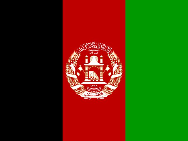
Qala i Naw
Badghis
Qala i Naw is the provincial capital of Badghis Province in Afghanistan. Situated in a rugged, mountainous region, the city plays a key role in the administrative and commercial activities of the northwestern part of the country. Historically, Badghis Province has been known for its agricultural produce, particularly pistachios. The city itself is characterized by its local markets and a traditional Afghan urban landscape. Due to its location and ongoing security concerns in Afghanistan, Qala i Naw is less developed for international tourism, focusing more on local commerce and administrative functions. Visitors would experience a culturally rich but infrastructurally basic Afghan city.
Qarchī Gak
Balkh
Qarchī Gak is a small village and former district in Balkh Province in northern Afghanistan, located in the flat agricultural plains north of the historic city of Balkh and west of Mazar-i-Sharif. The locality is best known for the remains of an ancient Buddhist stupa (locally known as the "Qarchi Gak stupa" or Takht-e Rustam in some references) dating to the early centuries CE, when the region of Bactria flourished along the Silk Road and supported a dense network of Buddhist monastic complexes. Today the area is predominantly rural, with its economy based on agriculture, particularly wheat, cotton, and melon cultivation supported by irrigation from local rivers and karez systems. The settlement is modest in size, and its significance for travelers lies primarily in its archaeological heritage and its proximity to Balkh — one of the oldest continuously inhabited places in Central Asia — as well as Mazar-i-Sharif. Travel to the area requires careful planning given the broader security context of northern Afghanistan.
Qarqīn
Jowzjan
Qarqīn is a district center located in Jowzjan (Juzjan) province in northern Afghanistan, situated at coordinates 37.41853, 66.04358. The area lies near the Uzbek border and is characterized by fertile plains and agricultural lands. Qarqīn serves as a local market center for surrounding villages and farms, with a population primarily engaged in agriculture, particularly wheat, cotton, and fruit cultivation. The region has a mixed population of Uzbeks, Tajiks, and Pashtuns, reflecting the diverse ethnic tapestry of northern Afghanistan. Tourist infrastructure is limited, and the area is primarily visited for cultural exploration, interaction with local communities, and understanding rural Afghan life. Visitors should note that travel to this region requires careful planning and consideration of local security conditions.
Rāghistān
Badakhshan
Rāghistān district is located in the Wakhan Corridor region of Badakhshan, Afghanistan, near the borders with Tajikistan and China's Xinjiang region. The area features dramatic mountain scenery of the Pamir and Hindu Kush mountain ranges, with the Oxus River (Amu Darya) flowing through nearby valleys. The region has been inhabited for millennia by Wakhi and Tajik peoples who maintain traditional pastoral lifestyles. Unlike more accessible parts of Afghanistan, Rāghistān remains largely isolated due to its extreme geography and limited transportation infrastructure. The district center is in the village of Rāghistān, which serves as a local administrative and market center for surrounding communities. The economy is based on animal husbandry, small-scale agriculture, and trade along historic caravan routes. Visitors to this region would experience authentic mountain culture and hospitality, though must contend with minimal tourism facilities and significant travel challenges.
Rūdbār
Nimruz
Rūdbār is a district located in Nimruz Province (also spelled Nangarhar or Nimroz) in southwestern Afghanistan. The area sits at approximately 30.15°N latitude and 62.6°E longitude, placing it in the desert plains region near the border with Iran. Nimruz Province is one of Afghanistan's 34 provinces, with Zaranj serving as its capital. The region is characterized by its arid climate, low population density, and proximity to important trade routes connecting Afghanistan to Iran. The local population consists primarily of Baluchi ethnic groups and Pashtuns, with the area holding historical significance as part of the ancient trade routes linking Central Asia to the Persian Gulf. Visitors to this area will find a stark, desert landscape with limited infrastructure and authentic traditional Afghan rural life far from major tourist circuits.
Sang-e Chārak
Sar-e Pol
Sang-e Chārak is a modest town in northern Afghanistan's Sar-e Pol province, positioned at coordinates 35.84972°N, 66.43694°E. The town sits in a valley area surrounded by mountains, with the Injil or Band-e Sultan mountain range to the north. As a small rural settlement, it serves as a local market and administrative center for nearby villages. The economy is primarily agricultural, with wheat, barley, and livestock farming dominating local livelihoods. The town has a traditional bazaar area but offers very limited tourism infrastructure. Access is via road connections to the provincial capital Sar-e Pol and the larger city of Sheberghan. Visitors to this area will encounter traditional Afghan rural life with hospitable local communities.
Sar-e Pul
Sar-e Pol
Sar-e Pul is the capital of Sar-e Pol province in northern Afghanistan. Located at coordinates 36.21544, 65.93249, it serves as a administrative center in a predominantly rural and agricultural region. The city sits in a semi-arid zone surrounded by mountainous terrain and agricultural lands. Due to decades of conflict and limited infrastructure development, Sar-e Pul has minimal tourism facilities and remains largely off the standard tourist circuit. Access to the city is primarily via road from major urban centers like Mazar-i-Sharif or Kabul. The local economy is based on agriculture, small-scale trade, and livestock husbandry. Visitors considering this area should be aware that tourism infrastructure is extremely limited, and travel advisories from many governments caution against all travel to Afghanistan due to security concerns.
Shibirghān
Jowzjan
Shibirghān is the capital city of Jowzjan Province in northern Afghanistan, situated on the banks of the Surkhab River. It has a rich history, dating back to antiquity, and was once a significant stop along the ancient Silk Road. The city's economy is primarily agricultural, with fertile lands supporting various crops. Shibirghān is also known for its natural gas reserves in the region. The city offers a glimpse into traditional Afghan life and culture, though it has seen various periods of conflict.
Tagāw-Bāy
Sar-e Pol
Tagāw-Bāy is a small settlement located in Sar-e Pol province in northern Afghanistan. The area is situated in a region characterized by agricultural plains and proximity to the Balkh River basin. Due to its small size, Tagāw-Bāy does not have major tourist infrastructure, attractions, or facilities. Visitors to this area would typically be traveling for regional business, family visits, or humanitarian work rather than tourism. The local economy is primarily based on agriculture, with wheat, barley, and cotton being common crops in the province. Travelers should note that Sar-e Pol province has seen improved security conditions in recent years, but travel to rural areas requires careful planning and local guidance.
Taloqan
Takhar
Taloqan is the capital of Takhar Province in northern Afghanistan, situated at the crossroads of ancient trade routes connecting Central Asia to the Indian subcontinent. The city serves as an important agricultural and commercial center for the region, known for its fertile plains that produce wheat, barley, and various fruits. With a populationprimarily consisting of Uzbeks, Tajiks, and Pashtuns, Taloqan offers visitors a glimpse into traditional Afghan provincial life away from the major tourist destinations. The city features a historic bazaar area, local crafts workshops, and proximity to mountainous terrain that attracts those interested in nature and trekking. The region's history dates back centuries as part of the Silk Road network, with various historical sites in the surrounding area reflecting its importance as a trading post."
Tarinkot
Urozgan
Tarinkot (also spelled Tarin Kot or Terinkot) is the capital of Urozgan Province in southern Afghanistan. The city is situated along the Arghandab River valley and lies along the road connecting Kandahar to Deh Rawood. The population primarily consists of Pashtun tribes, particularly the Popalzai and Alizai. The local economy is based on agriculture, with wheat, corn, and livestock being the main products. The city features a traditional bazaar area and serves as a market center for surrounding villages. Urozgan Province has historically been among the more underdeveloped regions in Afghanistan, with limited infrastructure and services. The area holds historical significance as part of the broader Kandahar region, which has been a strategic location throughout Afghan history.
Wākhān
Badakhshan
The Wakhan Corridor is a thin strip of territory in northeastern Afghanistan, forming a buffer between Tajikistan to the north and Pakistan to the south. It is characterized by its dramatic mountain landscapes, including parts of the Pamir and Hindu Kush ranges, and is home to the Wakhi and Kyrgyz people. The region is largely inaccessible, with challenging terrain and limited infrastructure, making it a destination for adventurous travelers seeking remote wilderness and cultural immersion. The Amu Darya river, fed by glaciers, flows through parts of the corridor.
Zaṟah Sharan
Paktika
Zaṟah Sharan (also spelled Zarah Sharan) is a small town located in Paktika Province in southeastern Afghanistan, near the border with Pakistan's Khyber Pakhtunkhwa region. The town serves as a administrative center for the surrounding rural area, which is predominantly inhabited by Pashtun tribes. The region features mountainous terrain and arid landscapes characteristic of the eastern Afghan highlands. Due to ongoing security concerns and limited infrastructure, Zaṟah Sharan is not established as a tourist destination and receives very few international visitors. The area has historically been affected by conflict and instability, and travel advisories consistently warn against all travel to Paktika Province due to the threat of terrorism, kidnapping, and armed conflict.
Zaranj
Nimruz
Zaranj is the capital of Nimruz Province, located in the hot desert plains of southwestern Afghanistan close to the Iranian border. The city sits at the terminus of the Kabul-Kandahar highway and has historically served as an important trading post facilitating commerce between Afghanistan and Iran. The surrounding landscape is characterized by the Dasht-e Margo (Desert of Death), an extremely arid region with minimal vegetation. The local economy relies heavily on border trade, agriculture (particularly date palms and melons), and animal husbandry. Zaranj features a small daily market where goods from both Afghanistan and Iran are traded. The city has a modest airport (Zaranj Airport) and connections to the national road network. Due to its remote location and extreme climate, tourism infrastructure is extremely limited, and visitors are rare. The region experiences scorching summers with temperatures exceeding 45°C and mild winters.
Panjāb
Bamyan
Panjāb district is located in the central highlands of Afghanistan in Bamyan Province. The region features rugged mountainous terrain characterized by the Hindu Kush mountain range. Historically, this area was part of the ancient Silk Road trade route and contains evidence of Buddhist influence from the 2nd-8th centuries CE. The local economy is primarily based on agriculture, including wheat and barley cultivation, and livestock husbandry. The population consists predominantly of Hazara ethnic group, who are Shia Muslims, along with some Tajik communities. The area offers limited tourism infrastructure due to its remote location and security considerations. Visitors interested in the region's historical significance typically travel to the provincial capital Bamyan city, which is home to the famous Buddha cliff statues (now destroyed but historically significant).
Aībak
Samangan
Aībak (also spelled Aybak) serves as the administrative center of Samangan province, one of Afghanistan's northern provinces. The city lies in a strategically important valley region at an elevation of approximately 1,100 meters above sea level. Historically, the area has been part of the ancient region of Khorasan and has seen various empires pass through, including the Persian, Mongol, and Timurid dynasties. The city itself is relatively modest in size, functioning primarily as a provincial administrative center with agriculture being the main economic activity in the surrounding area. The region is known for its production of wheat, barley, and various fruits, with orchards dotting the landscape. Aībak has faced challenges from decades of conflict but maintains a resilient local population engaged in trade, small-scale commerce, and agriculture.
Āqchah
Jowzjan
Āqchah is a small town located in Jowzjan Province in northern Afghanistan, situated at an elevation of approximately 370 meters above sea level. The town serves as a regional center for surrounding agricultural communities and lies near the border with Turkmenistan. The local economy is primarily based on agriculture, with wheat, cotton, and melon cultivation being major contributors. The population consists predominantly of Uzbek and Turkmen ethnic groups. Due to its proximity to the main highway connecting Mazar-i-Sharif to Sheberghan, the town serves as a transit point for goods and travelers moving between these northern Afghan cities. Āqchah is not a major tourist destination and lacks established tourism infrastructure, hotels, or restaurants catering to visitors.
Darzāb
Jowzjan
Darzāb is a small town located in the northern Jowzjan Province of Afghanistan, approximately 70 kilometers east of Sheberghan, the provincial capital. The town sits at an elevation of around 400 meters in the Amu Darriyah river basin region. As a district center, Darzāb functions as a local market town for surrounding agricultural villages, with the economy based largely on wheat cultivation, cotton farming, and livestock husbandry. The population consists primarily of Uzbeks and Turkmens, reflecting the ethnic diversity of northern Afghanistan. The town features a traditional bazaar where local farmers trade produce and goods. Infrastructure is limited, with basic amenities common to rural Afghan towns. The area has historical connections to the ancient Silk Road trade routes that passed through this region, though no specific preserved historical monuments exist in the town itself. Visitors should note that Darzāb is not a conventional tourist destination and tourism infrastructure is virtually nonexistent.
Fayzabad
Badakhshan
Fayzabad serves as the administrative and commercial center of Badakhshan Province, one of Afghanistan's most isolated and mountainous provinces. The town lies in a narrow valley along the Kokcha River at the foot of the Hindu Kush mountains, in the far northeastern corner of the country. Surrounded by some of the highest peaks in Afghanistan, Fayzabad is characterized by its dramatic alpine scenery, terraced agriculture, and traditional Pamiri/Tajik cultural influences. The region is historically famous as the world's principal source of lapis lazuli for thousands of years, with mines still active in surrounding districts. The town itself is a modest settlement of low-rise buildings, a central bazaar, and the provincial government compound. It functions as the principal staging point for access to the remote Wakhan Corridor, the Pamir valleys, and the Afghan side of the borderlands with Tajikistan and Pakistan. Population is predominantly Tajik/Pamiri Sunni and Ismaili Muslim, reflecting centuries of cultural and linguistic ties to Central Asia rather than the Pashtun heartland of Afghanistan.
Jurm
Badakhshan
Jurm is the capital of Jurm District in Badakhshan Province, located in the remote northeastern corner of Afghanistan. The town sits in a high-altitude valley near the Kokcha River system, surrounded by rugged mountains that connect the Pamir region to the rest of Afghanistan. It functions primarily as a local administrative and trading hub for surrounding villages, with agriculture (especially wheat, barley, and fruit orchards) and livestock being central to the local economy. Badakhshan Province is historically renowned for its lapis lazuli mines, and the broader region has long been a crossroads of Central Asian trade routes. The population is predominantly Tajik and speaks Dari (Afghan Persian) as the main language, with local cultural traditions rooted in Islamic heritage and Central Asian mountain customs. The town is isolated, with limited infrastructure, and serves as a staging point for travelers heading toward the more remote Pamir villages and the Wakhan Corridor.
Kushk
Herat
Kushk is a town located in Kushk district in Herat Province, Afghanistan, positioned at coordinates 33.29565, 61.95221. The town lies approximately 120 kilometers south of Herat city and sits close to the Afghan-Iranian border, making it an important regional trading and transit point. The local economy is primarily based on agriculture, including wheat and barley cultivation, along with small-scale trading and merchant activities. The population consists mainly of Tajik and Pashtun ethnic groups, with Persian (Dari) being the dominant language for daily communication. The town features a traditional bazaar area and serves as a waypoint for travelers moving between Herat and the Iranian border crossings. Infrastructure remains basic, with limited modern amenities, and visitors should expect a rural阿富汗 town atmosphere rather than urban tourism facilities.
Lab-Sar
Balkh
Lab-Sar (also written Lab-e Sar) is a small village located in Balkh Province in northern Afghanistan, near the foothills of the mountains separating the province from neighboring regions. Balkh Province itself holds exceptional historical weight, having been a major center of ancient Bactria and historically referenced as the "Mother of Cities." Lab-Sar itself is a modest rural locality characterized by traditional Afghan village life, with agriculture and livestock being typical livelihoods. The surrounding landscape of Balkh Province features a mix of plains, foothills, and seasonal rivers, and the broader region has been a cultural crossroads for Persian, Central Asian, Turkic, and Arab influences over many centuries. Travelers should be aware that Lab-Sar is a small village with limited tourism infrastructure, and most visitors to the province focus on the historic city of Balkh or the regional capital Mazar-i-Sharif. Security conditions in Afghanistan have historically been complex and should be carefully reviewed before any travel plans.
Larkird
Sar-e Pol
Larkird is a small rural settlement in Sar-e Pol Province, northern Afghanistan. Situated at an elevation in the foothills of the Hindu Kush mountain range, the village reflects the traditional rural character of northern Afghanistan, where communities are primarily engaged in subsistence agriculture and livestock herding. The surrounding landscape features arid mountains, scattered valleys, and seasonal watercourses that shape the local way of life. Like many small villages in the province, Larkird is closely tied to nearby district and provincial centers for commerce, services, and governance. The area is predominantly inhabited by ethnic Uzbek and Tajik communities, and residents typically communicate in Dari and local Turkic dialects alongside Pashto. Travel infrastructure in such remote Afghan villages is limited, and visitors should expect basic conditions and minimal tourist facilities.
Maymana
Faryab
Maymana is the provincial capital of Faryab Province in northern Afghanistan, situated on a plateau at an elevation of roughly 850 meters above sea level amid the foothills of the region's mountain ranges. The city has historically served as the seat of the Maymana Khanate, a semi-autonomous Turkmen principality that held sway over much of present-day Faryab until the late 19th century, and it retains a character shaped by its Turkmen, Uzbek, Tajik, and Pashtun populations. Its old town developed around a historic citadel and a traditional bazaar, and the surrounding province is known for its carpet-weaving traditions, particularly Turkmen and Uzbek flat-weave rugs. Maymana functions primarily as a provincial administrative and trading center, connected to neighboring provinces and to the Turkmen border by road. Travel infrastructure is limited and the security situation in Faryab has historically been volatile, which means visits require careful planning and current local advice.